 Systemic Studios
Systemic Studios, the makers of Tower Aim
Tower Aim is our app. This guide explains what to look for in any TV antenna app, compares the options fairly, and ends with our verdict, which recommends Tower Aim.
Start with the data: every licensed TV station in the US, and the hills in between.
Pointing an antenna for over-the-air (OTA) local channels comes down to two things: knowing where every station is, and knowing whether a hill is in the way. This guide covers what to check in an antenna pointing app, compares the apps and tools cord cutters use, and explains why we built Tower Aim around nationwide FCC data and a terrain check saved on your phone.


No ads, no account.
Here's how we compared the options, checked Oct 8, 2026. Weigh our verdict knowing that.
Tower Aim is our app. This guide explains what to look for in any TV antenna app, compares the options fairly, and ends with our verdict, which recommends Tower Aim.
An app can only point you at a station it knows about, and it can only warn you about a hill if it has terrain data. Check these two first.
No ads, no account.
Look for the data source, the date and the coverage. Tower Aim has nationwide FCC licensing (LMS) data: every licensed digital TV station, including US territories and low-power stations, plus nearby Canadian border stations. That is 7,088 stations across 3,234 sites, updated October 7, 2026, with off-air stations hidden.
See each station's network name, RF and virtual channels and transmitter power, with NextGen TV (ATSC 3.0) stations marked.
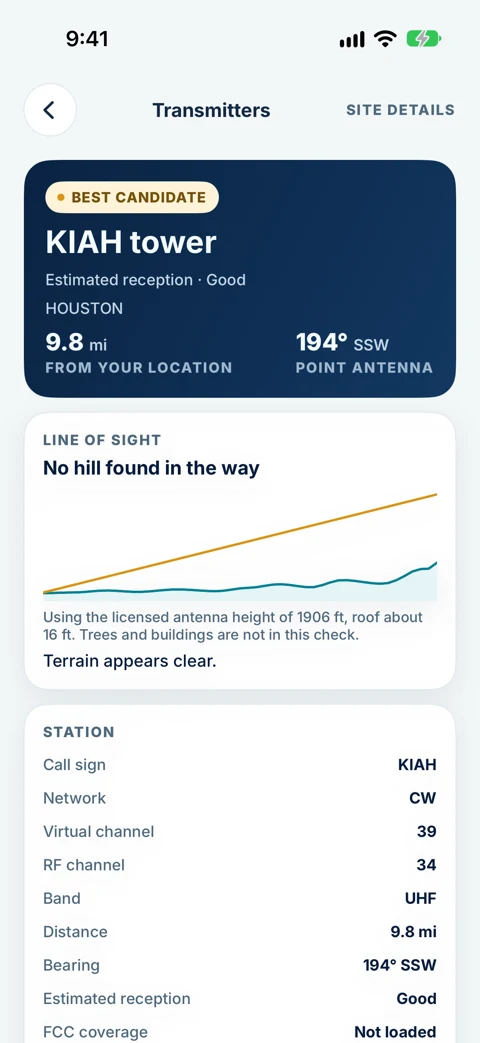
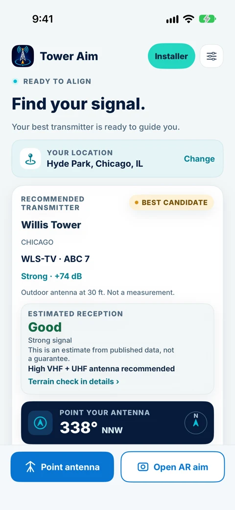
Tower Aim gives a predicted signal estimate for each station, checked against the FCC's own tool, plus a magnetic compass bearing. It is an estimate, not a measurement.
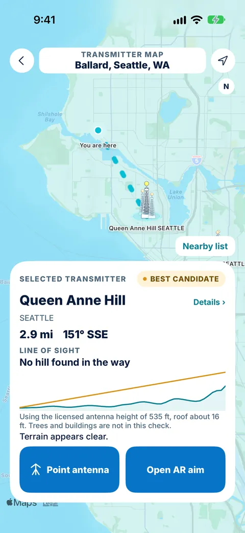
Look for a check of hills between you and the tower. Tower Aim shows the elevation profile from a one-time terrain download that stays on your phone. Trees and buildings are not included, so treat it as a guide.
Station data is built into the app, and the terrain map is a one-time download that stays on your phone. Tower Aim Installer adds finer terrain.
Once the data and terrain are right, these decide how easy the job is.
Cell service can be weak on a roof, in an attic or at a campsite. Check whether the app needs the internet. Tower Aim's station data is built in, and its terrain map is a one-time download that stays on your phone.
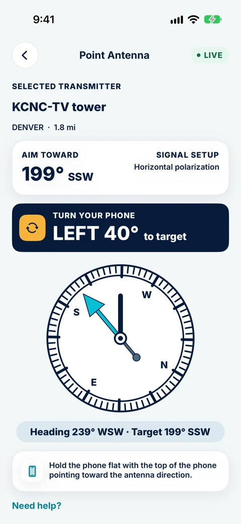
A live compass arrow is the basic tool. Tower Aim adds a locked target bearing, AR aim on phones that support it, and a clear on-target confirmation.
Phones cannot measure TV signal, so any rating is an estimate. Tower Aim rates expected reception from Excellent to Poor, labeled as an estimate, with Need help? steps if the picture breaks up.
Check whether there are ads or in-app purchases, and whether you need an account. Tower Aim is a one-time purchase, with no ads and no account.
For professionals: Tower Aim Installer keeps jobs by status, before and after readings from your own test equipment, photos, notes and dictation, and branded PDF reports.
Tower Aim runs on iPhone (iOS 17 or later) and Android (8.0 or later), for outdoor, attic and rooftop OTA antennas (UHF and VHF).
Data and terrain rows come first because they matter most. We only list features Tower Aim has.
| Feature | Tower Aim | FCC DTV Reception Maps | An antenna maker's app (iPhone and Android) | An antenna maker's iPhone app | A paid iPhone app | An app with ads (Android and iPhone) |
|---|---|---|---|---|---|---|
| STATION DATA AND TERRAIN | ||||||
| US station data | FCC LMS, every licensed station: 7,088 across 3,234 sites, updated Oct 7, 2026 | FCC | - | - | Over 2,000 stations and 1,000 repeaters | FCC |
| Network names and channels | Yes, RF and virtual channels, plus power | Call signs, RF channel | Network call signs, channel list | Channel list | Networks shown | - |
| NextGen TV (ATSC 3.0) marked | Yes | - | - | - | - | - |
| Predicted signal | Yes, an estimate checked against the FCC's tool | Strong, moderate or weak (assumes outdoor antenna at 30 ft) | Range rings (35, 50, 70 mi) | Yes, per channel | Coverage contour (needs a connection the first time) | FCC coverage areas |
| Terrain line of sight | Yes, from a one-time terrain download; finer terrain with Installer | Terrain-sensitive prediction, no profile view; online | - | - | - | - |
| Saved on your phone | Yes, after a one-time terrain download | No, website | - | - | Contours need a connection the first time | - |
| AIMING, ADS AND TOOLS | ||||||
| Type | iPhone and Android app | Website | iPhone and Android app | iPhone app | iPhone app (optional Apple Watch add-on) | Android and iPhone app |
| Ads and account | No ads, no account | - | - | - | - | Google Play shows ads |
| Live compass aiming | Yes | Map, no compass | Aim your phone toward the towers | Yes, compass heading | Compass tab | Bearing with compass |
| AR aiming | Yes, on supported phones | No | - | - | - | - |
| Magnetic compass bearing | Yes | - | - | Magnetic headings | - | - |
| Job records, photos, PDF reports | Yes, with Installer subscription | - | - | - | - | - |
Checked October 8, 2026 against each app's App Store (US) or Google Play listing and the FCC DTV Reception Maps. "-" means the store listing or website doesn't say, not that the app can't do it. "With ads" means the app's Google Play listing shows "Contains ads". Features change, so check the store listing before you download.
Short notes from each public listing, checked Oct 8, 2026. No scores or star ratings.
Government website
Good for: A quick check of what is available at an address: stations listed by predicted signal (strong, moderate, weak or no signal), each station's RF channel and its transmitter on a map. Predictions use a terrain-sensitive model and assume an outdoor antenna 30 feet above ground.
Not stated on its listing: The data date, or a terrain profile you can see. It is a website, so there is no live compass on the roof.
iPhone and Android
Good for: A map of towers with distances and 35, 50 and 70-mile range rings, network call signs, a channel list and step-by-step aiming tips.
Not stated on its listing: The data source or date, use without internet, a terrain check, AR aim, NextGen TV marking, installer tools.
iPhone
Good for: Address or ZIP code search, a tower map with an antenna pointer, a live compass heading, a channel list, predicted signal per channel and magnetic headings, for outdoor directional antennas.
Not stated on its listing: Use without internet, the data date, a terrain check, AR aim, NextGen TV marking, installer tools.
iPhone, optional Apple Watch add-on
Good for: A map of US stations (and some Canadian stations) with a compass tab, FCC coverage contours downloaded when you pick a tower, and an Apple Watch compass option. Popular with RVers.
Not stated on its listing: The data date, a terrain check, AR aim, NextGen TV marking, installer tools.
Google Play shows ads and in-app purchases
Good for: A quick bearing to nearby towers. In the US it shows FCC coverage areas and can filter out stations that are out of reach.
Not stated on its listing: Use without internet, the data date, a terrain check, AR aim, NextGen TV marking, installer tools.
Tower Aim: TV Antenna Finder · OTA Antenna Pointer & Compass
We make it, so weigh this accordingly. Against the criteria above, these are our reasons, data and terrain first.
No ads, no account.
Nationwide FCC licensing (LMS) data dated Oct 7, 2026: every licensed digital TV station, including US territories and low-power stations, plus Canadian border stations, with network names, RF and virtual channels, transmitter power and NextGen TV (ATSC 3.0) marked.
Terrain line of sight from a one-time terrain download, with finer terrain in Tower Aim Installer. None of the other app listings we checked states a terrain check or marks NextGen TV stations. The FCC maps factor in terrain, online.
A predicted signal estimate for each station, checked against the FCC's own tool. Always shown as an estimate.
Live compass and AR aim, with a locked bearing, a magnetic compass bearing and an on-target confirmation.
Tower Aim Installer adds jobs, readings from your own meter, photos, dictation and branded PDF reports.
Use the FCC DTV Reception Maps.
The paid iPhone app offers an Apple Watch add-on.
The basic apps give you towers and a bearing.
From the ground to on target, before you touch the antenna.
Open Tower Aim outside. It recommends nearby local stations by distance and published power.
See the bearing, channels and the terrain profile to the tower.
Follow the compass arrow or AR aim while you turn the antenna, then rescan your TV.
From the backyard to the whole job.
No ads, no account.
Get clear over-the-air local channels with the right aim. If your antenna is hard to reach, use a professional installer. Roof work is dangerous.
Find nearby TV stations wherever the road takes you, and check which tower to aim at each stop.
Confirm the station on site, then add Tower Aim Installer, an optional subscription, to keep jobs, readings, photos and branded PDF reports together.
Still deciding? See everything Tower Aim does.
No ads, no account.
At the station or group of stations you want. Tower Aim recommends nearby stations and shows the bearing and a predicted signal estimate for each one, so you can see which direction serves the channels you watch.
From FCC licensing (LMS) data dated October 7, 2026. Tower Aim has every licensed digital TV station, including US territories and low-power stations, plus nearby Canadian border stations: 7,088 stations across 3,234 sites.
No. Your phone cannot measure TV signal. Tower Aim gives a predicted signal estimate and an estimated reception rating. Installers can record readings from their own test equipment with Tower Aim Installer.
Station data is built into the app, and the terrain map is a one-time download that stays on your phone. Open the app once on Wi-Fi before you head up.
The elevation profile between you and the tower, so you can see if a hill is in the way. Trees and buildings are not included, so treat it as a guide.
Tower Aim is on the App Store and Google Play in the US. It is a one-time purchase with no ads and no account.
Yes. Stations broadcasting NextGen TV (ATSC 3.0) are marked.
The FCC DTV Reception Maps are a government website that lists the stations predicted at an address, using a terrain-sensitive model. Tower Aim is a phone app you take onto the roof or to the campsite: it guides your aim with a live compass or AR and shows the terrain profile to the tower.
No. We make Tower Aim. We compared published features only, from each app's store listing on October 8, 2026, and we show "-" where the store listing or website doesn't say, rather than guess.
iPhone with iOS 17 or later, and Android 8.0 or later, for outdoor, attic and rooftop OTA antennas (UHF and VHF).